Wednesday, June 12, 2013

One more dusty trail in Moab ......

We had a good plan for our last day in Moab.    Head up a canyon jeep trail to Canyonlands and return via another jeep trail, making a large loop.    We headed up the Shafer Trail, which followed the Colorado River for awhile.

Then if opened up , rough but easy.  

At about 11 miles up the trail, we came to the scenic point where Thelma and Louise vaulted themselves into fabled history.    Very pretty up there. 
And behind us, on the middle high mesa, is Dead Horse Point.
The road narrowed and we climbed on................
And then, we came to this barricade just as we were to enter Canyonlands.   You'd think they could have put the sign further down and saved us a lot of dust.    Luckily there was room to turn around.
In this area, is a large potash producing plant.   Potash is potassium chloride and is used in fertilizer.   The settling pools are a brilliant blue edged with the white sand-like substance....assume the water evaporates and the scoop up the residue.  
After making the long trip back down to where we started, we opted to go up Long Canyon Trail and then come down again......it's relatively short but very scenic.  


At Pucker Pass, this large boulder makes for a Kodak moment.  


Easy to see our route from high above.   The Colorado is down there in the faint green area and beyond is the LaSal mountain range.    We came back to a car wash.   
That evening we joined Joe and Gay for dinner and to get helpful hints for our next adventures in Kodachrome State Park.       It's about a 6 hour drive down there and we look forward to meeting up with Cay and Ron......old friends that we met up with last summer in Canada.    
Still making plans for the days and weeks to follow.................stay tuned.  

PS:    I put an email subscription box for the blog up at the top.....have no idea how it works but others use this so thought I would try it.        

Tuesday, June 11, 2013

Petroglyphs

The elusive bull frogs are hard to capture but this one got a bit too comfortable in the clover .   
 We took a late afternoon drive up the canyon along the mighty Colorado River to search for petroglyphs.   In some remote areas there are also pictographs but they have mostly faded away.   The difference is the pictographs are painted on the rock and the petroglyphs are 'pecked' into the varnish layer .... presumably with a sharp stone as they had no Dremels or sharp pointy metal objects.   These are dated anywhere from 1000-2000 BC to 1400 AD....as far as anyone can tell...who really knows.
 I like the small person and the large jackrabbit.    About a foot tall on the rabbit and high up on the wall which makes you wonder how they did it.
 This is the" birthing rock", right beside the road.    It has details on all sides but the most interesting one
 is of a birth....awfully big baby and the literature says it is feet first....sounds impossible but their sense of scale seems a bit off on most things.
 This one has various sizes of feet and a horse or deer or something.   Didn't the Spanish introduce the horse, so guess that's not a horse.
 This is supposed to be a bear.


 Relaxing outside the house in the beautiful evening glow.    Mornings and evenings are perfect.
This morning, I was able to register for the 3 classes that I wanted at Denver Botanic Gardens.....yippee.     It was stressful as registration started at 9 and classes fill fast.    Two of mine sold out shortly after I got in.    I'm so thrilled.     Paul successfully  did his thing and got us camping sites back in Denver in July and August.    And he's anticipating his return to the Parkers Picklers......!
And now, it's off on one more trail ride and then tomorrow we pack up and head south to cooler weather.    (yes, you read that right.....higher elevation......)

Monday, June 10, 2013

Arches National Park and Dead Horse Point

To try and beat the heat, we were out the door by 7 for the short 5 mile drive to Arches NP.   And already, the crowds were filling the parking lots of the various trails.   
 This is the Courthouse formation.....very imposing.
 The Window Arch Trail is short and gentle and perfect for the old and young.   For little effort
 we were able to see 3 different arches.    It was very tricky and annoying to try and capture the colors of the sandstone in this early hour.    The shadows were deep and I tried different settings with limited success.
 In the midst of the scrubby landscape, this large jackrabbit appeared, seemingly undisturbed by the humans.    I can't imagine how it survives without obvious water or succulent plants.

 This is the base of one of the windows.....without a person for perspective, it's hard to visualize its quite delicate size for holding up the top.  
 That is me and my shadown and the arch's shadow.    It started to get warm about this time.
You can see the size of this one with the people at the base.
 Despite the climbing temps we were undeterred and armed with plenty of water, we headed over to

 Devils Garden Trail.   The Japanese in their tour bus got there first.    You can pick them out long before they become recognizable as they come covered from top to bottom to ward off the sun....even wearing white gloves.    I'm sure their melanoma rate is a lot less than us uncovered wanderers in our shorts and tanks.   The trail was also gentle but had some steep ups and downs and was about 30 min one way.


 Not a collared lizard but colorful in it's red  dots.
 Our destination was Landscape arch and it was very hard to get a picture of it.   It's sort of like taking a picture of the Grand Canyon, which you see in 3D but just can't capture on film.     This was as close as we could get as parts of it fell off and it is now very thin at the top.   It happened in 1991 when some hikers were relaxing under it and heard loud cracking and managed to escape just in time.    One of them did capture pictures of it falling and they are posted on the signage.   Knowing that it actually did happen makes me reluctant to get under those arches and balanced rocks....I'm basically not very brave.

 Not sure what these very pale lavender small flowers are.....could be some type of aster.   My book didn't have them or at least in a form that I recognized.    Coming back to the entrance, the canyon provides very welcome shade.
 We were out about 4 hours in the heat and it became quite unbearable as we headed back for showers and lunch and maybe a siesta.........
 Later, we headed over to Dead Horse Point, a popular destination ...... legend has it that horses were rounded up on a peninsula over the Colorado River.....their exit was blocked and they all died.    I think they should have named it Pretty View or something that leaves a better image.
 If you look at that grey flat mesa in the center, at the  left base is Hurrah Pass, then go right to the taller redder mesa and on the other side is where Chicken Corner ends.  
 This is the majestic view from the overlook on Dead Horse Point.   The muddy Colorado River winds it's way thru the 2000 ft canyons.   Again, I had trouble getting the color I wanted.   You'll just have to come out and see it for yourself.
Here is the Prince's Plume......The bushy plant  puts forth many of these long spikes.

I enjoy several blogs of wanderers like us.......They share campgrounds and restaurants and must see sights along their travels.    It is a great resource.   One that I've followed recently is Joe and Gay's travels.   They are especially generous, giving great descriptions , excellent pictures and mileage and signage.    And then I discovered that they are camped in our CG !!   We were able to meet up and share tales of the road.       They will be here most of the month so we'll look forward to more catching up.   Thanks Joe and Gay for stopping by.!!

Sunday, June 9, 2013

Chicken Corner

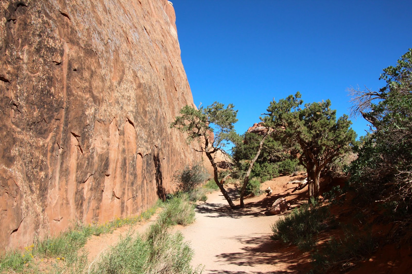
On Friday, we were anxious to try out our new 4x4 wheels.   We have an excellent guide book to the trails and chose one rated 'moderate' but....with a name like Chicken Corner, I just knew it wasn't going to be a Sunday drive in the country.      Eleven miles from downtown Moab, we came to a canyon and were quickly surrounded by the red towering sandstone.   Can you see the climber in the center...?    
 The road turned to gravel and we headed into open country.   We followed a stream and campers were scattered about in this harsh landscape.   Seeing them in their tents and few supplies that they probably carried in on their backs, makes me think that maybe we went a bit "over the top" in wanting to get back to Nature in our 40' "tent" with 3 TV's and a fireplace !!   But then I remember that we are OLD and have earned that comfortable queen sized bed.

 As we approached the walls of the canyon, the road became a red powder and in no time, the exterior was very very dusty.    We had the front portion of the top off (called the bikini top) and the dust and sun and heat were unrelenting.   But we had A/C, a GPS and enough supplies to last a week. I even brought the iPAD....because if we were going to be lost, at least I could read a good book !!
  Once we left the stream, we saw no one the entire trip out and felt like we could really disappear out there and never be found.......and I soon realized that the iPad would only be good as a photo album.

 After 11 miles, we reached  Hurrah Pass.    Would like to know the story behind the name.
 The road got rougher  and required more maneuvering over rock and up and down staircase-type paths.   It was bouncy.    Most would have air-downed the tires ( I think I made up that word but you know what I mean )  but we opted to keep the pressure up for this trip so that made it even rougher.

The vistas were amazing.   The Colorado River flowed below us and we saw an occasional boat.   We twisted and turned on shelf roads with sheer drop offs.   I just don't look or take pictures and I have the white knuckles to prove it.   The driver asked me not to gasp or cry out but just watch for on coming vehicles.......as if there were other's wanting to do this !!


Finally, after crawling up and around and down and squeezing along on very narrow and blind corners, we reached our destination.     Chicken Corners is named this becasue of a very treacherous trail that winds around the canyon wall and if the cowboy got off his horse
 to walk, he was called a chicken.    That trail goes around that large wall.....Paul walked out part of it but I just couldn't.   Call me Chicken !
Somewhere, across the river, was the point at which Thelma and Louise made their flying leap.   We could never figure out from which point it was filmed.  Now I wonder how they did that....Photoshop ??
    And then along came 3 couples on ATV's .   They were from Salt Lake City and also brought a golf club and some balls and tried their best to get a ball far enough out to reach the river.    One made it.   I thought they were too close to the edge and nervously hung back hoping they didn't lose their balance and join their golf ball in flight.     I was very glad when they stopped.  
 The return trip seemed more relaxing but no less jarring and challenging.
 We stopped to smell the roses..... of the prickly pear cactus.
 On the directional sign, that yellow thing is actually a stuffed chicken......!
 The trip took over 6 hours and we were in need of some shade and lunch about this time.    We gave in to dust and heat and put the top back on....
 This collared lizared posed nicely.    We saw little quick ground squirrels and more small lizards and some type of yellow daisy.   I was convinced I'd see some venomous creature as I tiptoed thru the dirt to the flowers.    

When we got back to civilization and phone service, we got the news that our new graduate, Alex, had broken a bone near his ankle and is out of commission for at least a month.    This kid has broken more bones ....we thought that taking up golf might be a gentler sport but he did it playing basketball with friends.    I should  teach him to knit and be lazy but knowing his intensity, he'd just sprain his fingers.    

In the morning, we plan on doing some short hikes before the heat becomes intolerable.  The books say to tell someone where you are going... so write this down...........The Windows Trail and Double Arch Trail.