Wednesday, August 1, 2012

The Acadian side of things......

I won't refer to the map today but it is helpful in getting an idea about the history of this beautiful place.    Nova Scotia , New Brunswick, Prince Edward Island were originally French (Acadian) along with Maine in the 1600-1700.    They left France to find peace from all the wars with Britain and settled throughout this region.    The British also came, mostly Scottish (gaelic).    The western part of Cape Breton Island is predominately French, with Acadian culture dominating and dependence on the sea for their livelihood.     In the southern part, Margaree Valley (near us) is a beautiful place of rolling hills, lakes and forests....this is the Scottish/British section and agriculture is dominant.   The Eastern and Northern section is the Scottish Highlands......people who have been to Scotland say this area is just like it.    The music, the food and the crafts reflect this heritage.   
We wandered on some back roads on Monday and happened upon this farm which advertised a yarn shop.    We drove up the long farm road to find a small farmhouse, some sheep and this building for housing farm equipment

and the delightful yarn shop.    The owner, in her 30's came down from the loft, knitting as she walked down the stairs.   She said the farm had been in the family for over 200 years.    The yarns were lovely as were the knitted/felted items.    Of course, I had to walk away with something so picked up one of the colorful hanks of yarn to the left of the window for some wool sox. 
 Crafts are a big industry on the island and rug hooking among the Acadian French is proudly displayed  and sold.   I picked up two small pieces to use as coasters in the motorhome in the seaside community of Cheticamp.   


On Wednesday, we headed out for a recommended hike on the Western side (the Acadian side) of the island.   The coastline is rounder and less rugged ..... the body of water is the St Lawrence Sea and is a popular whale watching area.  
We chose Skyline as it is considered "the premier hiking trail in Nova Scotia".   The parking lot was busy, the sky was clear blue and the temperature was in the 70's when we left home.   We should have checked it  before we started out.......(it was 84 when we got back to the car).

It was HOT......and aside from this stretch, there was NO shade.....and no breeze.  
This was a more typical view of our walk, high, with a view of the sea and...did I mention NO shade.   Luckily, the trail was fairly mild but mostly uphill on the way back.
Pretty ground berries along the way..........we saw 1 robin, 1 little brown bird, 2 seagulls, 2 small orange butterflies, no whales, no dolphins, no eagles and no relief from the sun.    We did bring hats but it was too hot to wear them with my thick hair.
We only followed one route instead of the loop as it was reported to be very rugged.

At the end of the trail is a boardwalk leading down to look-out areas.....where we'd hope to spot Pilot whales......but they were deep in the water, trying to avoid the sun also.   
We ate our PB&J lunch and headed back uphill.    It would have been a nice walk on a cooler, breezy day but we won't repeat it anytime soon.     We ended our jaunt at the local Tim Hortons for ice cold smoothies.........

Saturday, July 28, 2012

Sheep and turkeys

Nova Scotia is all of what we had hoped and then some.....we did very little research .... just got in the 'moving roadblock' and drove towards the sunrise....... initially, we planned for 4 days here.....but soon learned that we needed at least a week....and now we find that we need TWO weeks.   We need not rush thru these days....we have no schedule, no plan and nothing but time.          

And there is a lovely yarn shop nearby ....with plastic wool on the hoof.  

 It's time to go back to the map.    We are at the southern end of the Cabot Trail ( yellow)....near a very large scenic salt water lake.   Yesterday, we headed out in the mist and fog and followed the Bras d'Or lake on the green road towards the Northeast to Sydney.   That area was once a vibrant industrial complex and cod fishing center.    Now, it is rather gritty and unexciting.   You can catch a ferry to New Foundland if you so desire.   
Our destination was the Fortress of Louisbourg....30 min south of Sydney.
I tried to link to it but the wifi is slowing down so all you history buffs can just check it out on Bing for yourselves (and enjoy the daily photo)....Any way, the Fortress was a major French stronghold  in the 1700's as they attempted to hold on to their acquisitions.   The original settlement was in 1713 and after two sieges by the British, it was destroyed in 1758.   In 1960, partial restoration began using the unemployed coal miners from the area.   Original stonework was used and it is the largest historical restoration in North America....only 1/4 of the original was completed.

 It is very well done with real sheep and

interpretive guides in period costumes and regular demonstrations of daily life.


In a field  was this wild turkey and his handler......the handsome bird strutted about, undeterred by photographers and delighted children.
Note the change in color of his waddles (I had to look that one up !)  If he's excited it turns blue....which it was when we first saw him and then turns red when he is ready to fight !    I could see no change in his demeanor the entire time so I think he just did it for our benefit....and the camera.


While I was enamored with Tom, Paul was surrendering after breaching the wall around the fort.   By a woman no less.....don't think he put up much of a fight since he only had his umbrella.
It's hard to capture the  size of this place but I got a quick view from across the water.
The tiny village of Louisbourg has lovely B&B's  and several restaurants
and Darlene at the Visitors center knows everyone and everything.....fishing and tourism keep the town vibrant.
The drizzle continued but it wasn't cold and we made a quick trip out to view the solitary lighthouse.

before we drove home along the lake..............

Wednesday, July 25, 2012

Cabot Trail

The Cabot Trail is a 185 mi circle tour of Cape Breton Island, Nova Scotia.      Altho it was named after the explorer, it is believed that he actually landed in Newfoundland in the 1400's.   This road was completed in 1932 and surprisingly, is open all year round.    
We are camped a bit west of the village of Baddeck at the southern end.  We started our trip counter-clockwise as we had heard that most do it the other way and also, we would be on the ocean (scenic)  side of the road.   But, being a Monday, we practically had the road to ourselves.  
One of the first sights is a view of Cape Smokey, a prominent outcropping that is visible along most of the eastern coast.   The road climbs to the top for wide ranging vistas.

One of our plans was to try a hike along the coast.    The weather was perfect except for the winds which made wearing a hat impossible.

We could see our destination off in the distance.....
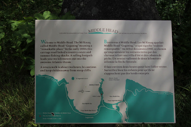
This signage below was very confusing to me as the land is in the aqua and the sea is white......

At 2.4 mi long and a recommended time of 1-2 hours, this seemed to be a very comfortable jaunt for us.
The sights around every corner were majestic....Cape Smokey in the distance.


At the end, it was a sheer cliff with no fencing ..... the water was crystal clear and we looked for whales but none appeared......
but many gulls diving for food......

The trail was not all smooth sailing......not sure what Paul is pointing at but it was the only good picture of the climb upwards .    We finished in a bit under two hours, including pondering life on some benches along the way.    Surprisingly, the strong winds on the trail were not as bad  at the point.....
We ended our stroll at the beautiful Keltic Lodge.   It is government owned and very appealing.   Reminded us a bit of the lodges at the national parks altho not as rustic.
Located on this peninsula is the historic  Highlands Links Golf Club
It has a significant slope rating and the staff said it was difficult but he also said that it was a course that   every golfer should play.   It is considered the #1 public golf course in Canada and has a significant history....check out the link for gorgeous views and info.    We are thinking about playing but the weather might not cooperate and then the weekend crowds fill it up.   But it's on my list of things to do .... someday.
This church is fairly typical of the anglican style.   The golf course winds around it.
Located within  the Cabot Trail is the Cape Breton Highlands National Park.    The Scottish influence is evident everywhere....from the gaelic signage to the tartan souvenirs.    Over 80% of Cape Breton Island is descended from the British Isles, and about 18% are French and reside on the western side.     We had only planned on doing half of the Trail but instead of retracing our steps, we just kept going around.....and then the skies darkened and the rain moved in.    This area is very dry and they welcome the rain.    It has rained heavily all night and is forecasted to be wet all of Tuesday.    I think there is a yarn shop waiting for me in Baddeck and then a good book.